GEOHISTORICAL GALERY - 4. view
Continental Drift and Plate Tectonics
12th October 1492, the ships of Christopher Columbus reached the Bahamas, and with this, after the Vikings the Europeans re-discovered the American continent. Nearly 80 years later, Abraham Ortelius Flamish cartographer and geographical scientist, who made the first modern atlas, Theatrum Orbis Terrarum (1570), called the attention to the fact that the east coast of America and the west coasts of Africa and Europe, which are 2800 km far, are almost completely fit together. The atlas raised the issue in its 1596 Antwerpen edition that the three continents were probably carried away from each other by earthquakes and floods.
Several natural scientists (for example Francis Bacon and Benjamin Franklin) dealt with this interesting fact, but none of them could give a satisfactory explanation. In the second half of the 19th century many people agreed that once a supercontinent (Gondwana) had to be exist, as well as the ocean, named Tethys. At last, taking into consideration fossils, which have been found in the southern hemisphere, geological evidences and earlier theories, Alfred Wegener German meteorologist, polar researcher and geologist created the theory of continental drift (1912). According to this, continents were not always in their recent places, but they moved significantly as compared to each other, moreover a long time ago they formed parts of Pangea, which was the sole fragmented continent.
The continental drift served as basis to the model of plate tectonics, developed in 1960 and accepted todays, and it gives a roughly acceptable explanation to the shape of continents and their always changing geographical position.
Fig. 1 Abraham Ortelius (1527–1598) Flemish cartographer and geographer on painting of Peter Paul Rubens (Museum Plantin-Moretus, Antwerp)
Fig. 2 Alfred Wegener (1880–1930) German polar researcher, geophysicist and meteorologist during Johan Peter Koch's Expedition in Greenland in 1912–1913
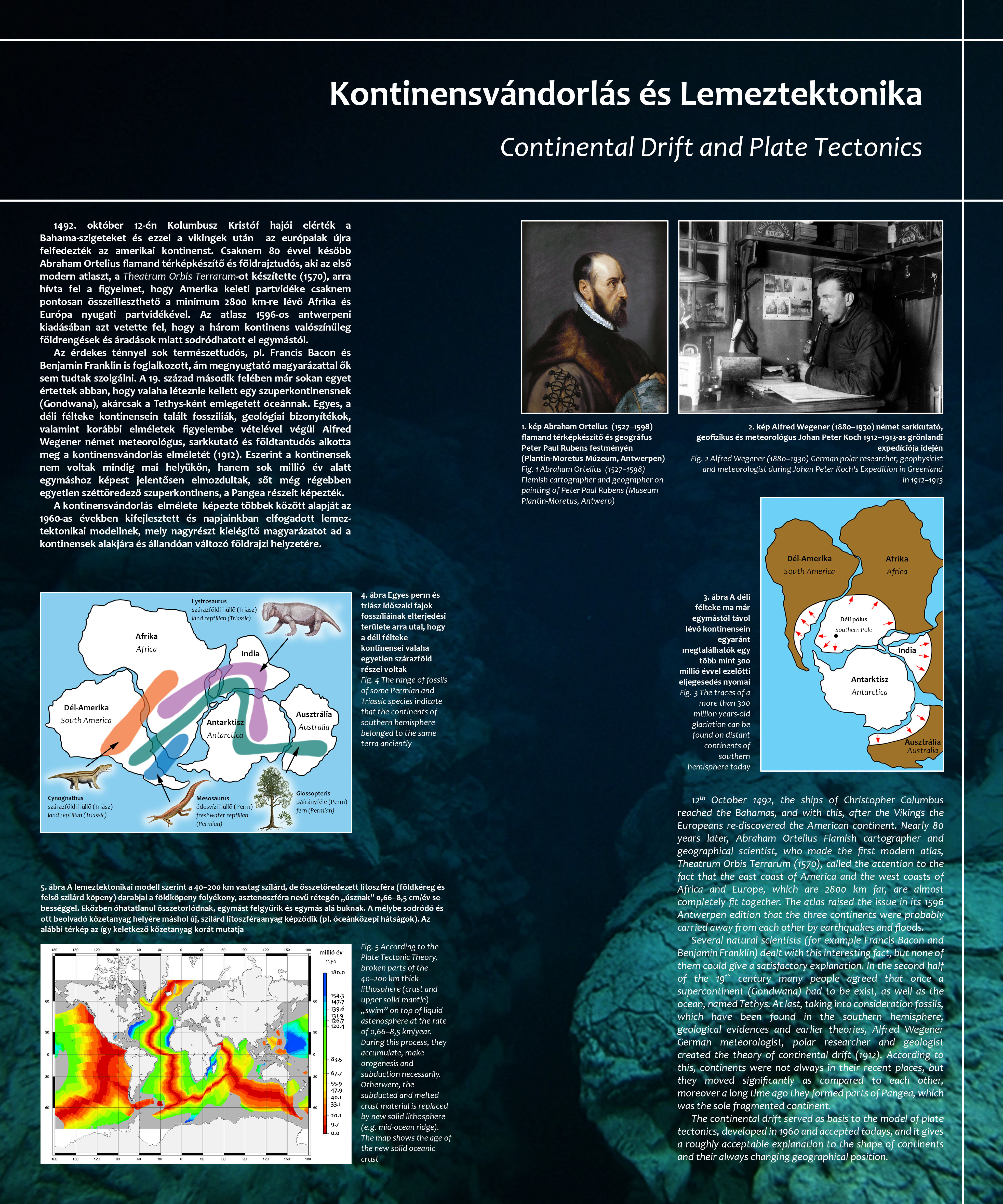
Fig. 3 The traces of a more than 300 million years-old glaciation can be found on distant continents of southern hemisphere today
Fig. 4 The range of fossils of some Permian and Triassic species indicate that the continents of southern hemisphere belonged to the same terra anciently
Fig. 5 According to the Plate Tectonic Theory, broken parts of the 40–200 km thick lithosphere (crust and upper solid mantle) „swim” on top of liquid astenosphere at the rate of 0,66–8,5 km/year. During this process, they accumulate, make orogenesis and subduction necessarily. Otherwere, the subducted and melted crust material is replaced by new solid lithosphere (e.g. mid-ocean ridge). The map shows the age of the new solid oceanic crust